
Please email all questions about submission to waverleychallenge@transport.nsw.gov.au. Questions and answers will be published and publicly available on this page.
FAQs
What is MaaS?
MaaS (Mobility as a Service) is the concept that all travel options can be accessed through a single platform or app, allowing customers to have a seamless travel experience by empowering them to plan, book and pay for their travel in one place.
Why is the challenge being run?
A combination of emerging technologies are creating new opportunities to deliver transport in a more efficient and cost effective manner. This trial is being run to analyse the effectiveness of integrating physical kerbside space, data, shared transport and public transport services into a single user friendly digital product. The trial aims to reduce congestion and the dependency on private car usage in the Waverley Council Local Government Area (LGA) by increasing access to a variety of new integrated mobility options.
What is being offered as part of the challenge?
Transport for NSW (TfNSW) and Waverley Council are offering the public an opportunity to collaborate with stakeholders and industry partners to provide a MaaS solution for Waverley Council residents. Benefits for the successful individual or team include options for seed funding, product endorsement from TfNSW, access to subject matter experts, data, APIs and significant commercial opportunities that stem from solving a real transport problem. Work with us to develop world leading solutions and contribute to the future of transport in NSW. Further details about the benefits of the Innovation Challenge will be provided at the Information Session.
What is the difference between the original MaaS Innovation Challenge 2019 and this opportunity?
The MaaS Innovation Challenge in 2019 included trials of a number of different MaaS solutions. This new challenge is with Waverley Council and provides a unique opportunity to combine kerbside management along with the lessons learnt from MaaS Innovation Challenge in 2019.
What is kerbside management?
It is the management of parking, pedestrian and traffic to ensure the safety and welfare of those visiting the Waverley Council LGA.
What are Pick-up/Drop-off?
Pick-up/Drop-off zones (PUDO’s) are especially assigned kerbside spaces that Waverley Council has set aside to make room for new customer transport offerings.
Where will the trials take place?
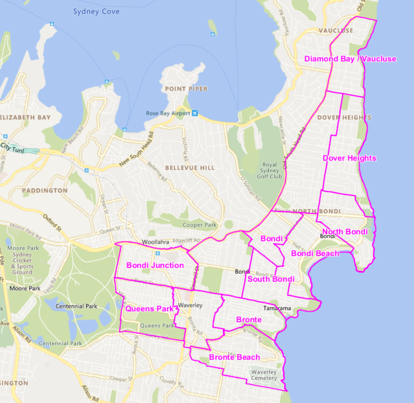
The trial will take place in the Waverley Council LGA in the eastern suburbs of Sydney, New South Wales.
Source: https://www.waverley.nsw.gov.au/residents/precinct_committees/finding_your_precinct
How will the Waverley Innovation Challenge work?
An Information Session was held on Thursday, February 6 2020, 5:30pm - 7:00pm at the Waverley Council Chambers building located at 49A Bondi Rd, Bondi Junction, and a recording will be published on the Waverley Transport Innovation Challenge webpage. This session was designed for interested parties to ask questions and get information before applications are due. Applications opened on Thursday 6 February 2020 and will close on Wednesday 19 February 2020 at 11:59pm. Potential applicants had the opportunity to meet key subject matter experts at the information session to help develop their submission. Once applications close, they are assessed and ranked by a screening panel. Individuals or teams will be selected to progress to the next stage of the challenge where they will be invited to pitch their ideas to the judging panel as part of the Pitch Day. The successful individual or teams will be invited to incubation. The incubated team will gain access to subject matter experts, and support in scoping a customer trial. If successful in completing the incubation stage, they will be assessed for endorsement.
Who can participate in the Innovation Challenge?
We welcome all submissions of viable options for MaaS. It is expected that the individual or team are incorporated and are able to engage in legal and/or commercial terms with TfNSW. Employees and the immediate families of employees of the TfNSW - including TfNSW, Sydney Trains and NSW Trains - are not eligible to enter the innovation challenge.
JUDGING CRITERIA
What criteria will the judging be based on?
The judging criteria are as follows:
- Customer Experience and Usability - is the solution appealing, effortless, intuitive and easy to use?
- Market Feasibility - Does the solution demonstrate knowledge of Transport’s customer base and will it be available to most people?
- Innovation - Is the product unique and original, and does it demonstrate tangible technical innovations?
- Commercial Sustainability - Can the idea sustain its commercial momentum? Is it likely to be profitable in the long term?
- Technical Feasibility - Can the team deliver the solution? Can they demonstrate an understanding of technical inputs to solution development and ensure ongoing technical stability?
Where do I apply?
Applications are open on the official Waverley Transport Innovation Challenge page from Thursday 6 February 2020. Subscribe with your email address to be advised of key events and news about the challenge.
What is the best way to connect and stay up to date?
Announcements via Twitter: @DataTfNSW | #WaverleyChallenge
Add your email to our contact list
Join the developer forum: https://opendataforum.transport.nsw.gov.au/
Technical issues and general enquiries: waverleychallenge@transport.nsw.gov.au
What other opportunities are there to engage with Transport for NSW?
TfNSW regularly runs Hackathons and Innovation Challenges. For information about when these might be occurring please visit the Innovation page of the Open Data Hub.
Questions and Answers from the Community
How did the council collate and gather the data?
This has been going on for more than a year. You’ve all shared information and that has been enormously helpful. We've been overlaying those [data] sets together. What we’ve identified is that Bondi Beach and Bondi Junction are high use locations. There's a huge amount of overlap of transport modes in high use locations.
Kerbsides are valuable and highly contested - everyone is interested and wants access to it. We’re hoping now to open it up broadly as a community facility.
A lot of congestion comes from people circulating, looking for parking. Wouldn’t it be good if we could give customers assurity of a parking spot? It’s a challenging thing. It’s a high benefit area to invest in.
How do you do it? There’s no other way than a parking survey. There are some vendors who do it. That’s part of the data feedback that will come out of this project. The data from identified and unidentified PUDO bays is something the council needs to know.
The more we can justify the councils investment in these spaces, the better. We’re giving up parking revenue, loading zones and so on, so we need to demonstrate these are valuable.
We’ve previously worked with Waverley Council on cycling routes and the data is first generation. There is a usability issue in terms of the routes themselves such as cycling routes that actually contain stairs. Do you have any thoughts about those kinds of barriers to routes? The way the technology is run can impair the solution.
Cycling routes are a hard thing to manage and can be costly. One of the datasets that Waverley Council will be providing is an accessibility dataset.
For TfNSW, we’re actively using OSM. It’s now the underlying base map. In addition, 2 days ago we signed a waiver to allow people to use our open data to update and improve OSM maps themselves. We also have a dedicated data team looking at trying to keep it up to date. OSM also underlies our trip planner. Crowdsourcing data is something we’re actively looking at, particularly for bikes.
What about the underlying route network? Google are always late, for example when Anzac Parade was under construction.
We talk directly to Google, and there are areas in the Sydney Coordination Office who report road closures directly to Google. Google do not always get it into their base map in time - so we acknowledge there is a real time issue there - but we are proactive about trying to get data through to them.
Especially given the recent fires, they’re aware of road closures that may have occurred because of that which did not make it into Google Maps. They’re trying to get live traffic data improved and more regularly updated in the future.
You would not be interested in having a navigation network you’re in control of? Google are traditionally slow. SOPA shut 2 main car parks during an event but Google didn’t want to know about that. Will you ever have your own route network that sits parallel to Google or just live the good and the bad?
The underlying map for TfNSW Trip Planner is Open Street Map (OSM). Our route planning is not done through Google Maps. We don’t use Google for our route planning though we do work with them as closely as we can, and are looking at SOPA data to see what we can release through the Open Data Hub.
We provide a single solution - we’re a platform for sharing private parking spaces. For this challenge, are you looking for a more holistic MaaS solution? How would - and should - a single service player like us apply?
The high level answer is focus on the Waverley area. For this challenge, it needs to satisfy the Waverley Local Government Area (LGA). That said, if we could get success here, it could become a mass offering. This product will likely be an aggregation service.
For most people travelling in Waverley, the origin or destination of their trip may lay outside the Waverley LGA. Should the solution treat waverley as an island or aim to be the full experience?
The full experience. To get a solution that satisfies everyone is hard. We’ve seen products that are hyper-localised to their customers have greater success. There is broad thinking about where the journeys are within Waverley - they’re within the area, Waverley to the city, Bondi Junction to Bondi Beach, to and from the airport, and to other beaches like Coogee and Maroubra.
What is TfNSW’s willingness to support the solution as it comes with it’s own infrastructure? What’s the integration you see? Is there wayfinding, marketing on buses, and so on, to really drag this home and really make it more than what an individual provider could generate on it’s own?
The answer is yes. There’s an appetite for it. Back in 2012 with early real time apps we had an appetite for promoting that on public transport and it’s the same now.
In addition, Waverley Council will be promoting the solution within the area too, absolutely. We will literally be painting the road orange. If there are QR codes to link physical space back to an app too? That’s great.
Is there any appetite for bringing more shared capacity into the area or just the integration of what is already there? Is there enough capacity?
The starting point is who’s here already. I’m not aware of anyone else who’s trying to come into the market in the Waverley LGA right now. If we drove new and different providers through this initiative, that would be…my first reaction is that that sounds like more cars.
Tell us a bit more about long term profitability? Are you looking for a B2C solution?
We’re looking for a sustainable solution. We’re not a revenue source and we’re not procuring.
Moving back to the challenge objective & reducing congestion, the areas identified for PUDOs in Bondi Junction and Bondi Beach are already well patronised by high density transport options like public transport. How do the PUDOs prioritise the use of such heavily congested space?
Ideally, from Waverley Council’s perspective, we’d like to see as much integration with Public Transport as possible. PUDOs reflect what’s already happening - those services are already there and operating, and there’s a lot of activity.
This [the PUDOs] is in part improving those services, creating an improved experience for residents and visitors to the Waverley LGA. That said, yes, we would like to see as much integration with public transport as possible.
It’s a known interchange - Bondi Junction is an interchange. To get different modes of transport in the interchange we think will be a significant step forward. Getting space to do something is getting harder and harder. It’s carving out that space which is useful for those providers.
Is it for those who need it (ie. impairment) as a priority? It seems a bit confusing as to why PUDO bays are in an area that is highly congested.
This is about the opportunity to spread into other areas as well.
I’m a waverly resident who chose not to buy a car. My experience in using MaaS apps already out there... things like CityMapper work very well. I’m hearing that you actually don’t want another app, but you want some of the existing services to work better. Having lived in London, the services not only tell you the time of the journey but also the level of comfort and the cost you can expect. It seems to me that there is a lot of choice here in what direction you could take the pilot.
We don't want another CityMapper or Google Maps. We wouldn’t stop it, but we’re not looking for that in this challenge. We think there is more that can be done. Extending apps that already exist, maybe. It’s not another of the same. It would make a crowded market even more crowded.
It’s contingent then on TfNSW extending the open data sets that are available. A lot of it comes down to what data you can make available on your platform around comfort, cost, etc. How ready are you to invest in updating the Open Data platform to support this pilot?
The Open Data Hub has a lot of data already. If there’s more you’d like to see then please put in a suggestion, because we are open to making more data open. If there are third parties with data they want to make open, we’re also looking into doing that on the Open Data platform. We’re putting car park data out there and are looking for more of that if parties are interested.
Can you provide a ballpark maximum for the seed funding? $15k/$30k/$60k? Assume the proposed solution can achieve all the objectives.
Our expectation is based on previous innovation challenges that ranged from $30,000 - $100,000
Can you provide an estimated number of monthly active users for the 12-month trial period?
We cannot estimate the monthly active users as a trial of this type has never been implemented in the area. We would look to the applicant company to set such targets and demonstrate how they would be achieved and post-trial how to scale to a self-sustaining product.
There’s mention of GTFS-Pathways in the slides. Can we expect a pathways.txt in a GTFS bundle, specifically for Bondi Junction Interchange? If yes;
- Would it be in the “Public Transport - Timetables - For Realtime” GTFS bundles, or the " Timetables Complete GTFS" bundle?
- Which of the optional fields would be implemented? length, traversal_time, stair_count, max_slope, min_width, signposted_as, reversed_signposted_as
The short answer is no. This is desired but has not yet been developed.
Is there a marketing budget from either TfNSW or Waverley Council? If yes, may we know the amount? Is it dependent on the seed funding required?
There is no assigned marketing budget. However, in terms of supporting the trial, it was discussed at the information session that there is an appetite for TfNSW promoting the trial on public transport, and Waverley Council will be promoting it locally as well. There is no reason why you cannot include marketing as part of your breakdown in your seed funding amount request in your application form.
What is the expected interaction between the successful vendor, TfNSW and Waverley Council past the incubation period and go-live?
For the duration of the trial we expect the successful participant to provide data and feedback to better enable a MaaS ecosystem in the Waverley Council and surrounding areas. Past the trial period we would encourage continued lines of communication, however there is no obligation beyond adhering to our protocols of engagement.
Does the solution need to be hosted in Australia to be successful?
No. We do need the solution hosted in a suitable location, however that does not need to be in Australia. We require customer data to be stored in suitably secure ways.
Are TfNSW/Waverley Council open to affiliation agreements, revenue sharing and other means of monetising this service directly with providers to make it sustainable?
Yes, we would encourage the vendor to suggest ways of making it sustainable. TfNSW/Waverley will not be involved directly in service provider agreements however will provide support where possible to improve the outcome of the trial.
If available, do you prefer native apps, a web app or both?
There is no preference. Applications will be judged on what provides the best user experience.
With personal vehicle journey planning, are you open to passing turn-by-turn directions to a third-party mapping app?
This will be up to the applicant to decide.
Can you share additional insight into what information will be provided in the Waverley Accessibility Data Set?
This information will be shared shortly on the Open Data Hub and Open Data Forum.
Which projection is being used for the PUDO zones? I’ve narrowed it down to these:
- EPSG:20256 Name:AGD66 / AMG zone 56
- EPSG:32356 Name:WGS 72 / UTM zone 56S
- EPSG:32556 Name:WGS 72BE / UTM zone 56S
- EPSG:32756 Name:WGS 84 / UTM zone 56S
- EPSG:28356 Name:GDA94 / MGA zone 56
It’s GDA94 / MGA Zone 56
In the FAQ section you mention the lessons learnt from the first challenge. Where can we gain access to these lessons learnt?
1. Developing and establishing a commercially sustainable business model appears to be a challenge for both MaaS Operators and MaaS apps.
a. This includes defining or implementing a method to extract value or the right fee structure through the supply chain.
2. Addressing privacy concerns will need to evolve within the MaaS ecosystem to enable data sharing. For example: customer terms and conditions are needed so that data can be shared between different entities.
3. Greater customer awareness of transport options is needed:
a. To provide viable alternatives to private car use resulting in congestion reduction and single passenger car use.
b. To affect customer behaviour changes
i. Multimodal trip (ie a move away from single mode travel)
c. However commercial interests may not provide the best available options (e.g. free community shuttle services may not be beneficial for MaaS apps to display)